Reduce your personal risk (created by Michael Paine, May 2008)
Be alert and prepared - not alarmed.
This is a low-probability, high-consequence event that
calls for a little preparation in case a warning is
issued. These are similar to the things that people do to
prepare for cyclone warnings in tropic areas and bushfires. The
following advice applies mainly where there is no local
tsunami action plan.
Although the likelihood of a mega-tsunami is low there are some
simple things you can do to significantly reduce the risk of
fatality:
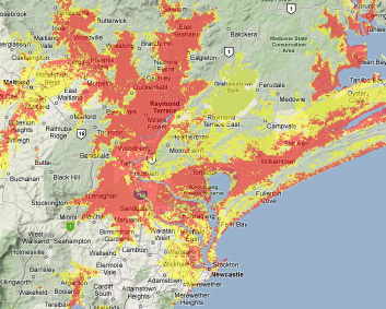
- Identify if you live, work or play in a vulnerable
location - find out the approximate height above mean
sea level. As a rough guide coastal
and estuary land less than 10 metres above mean sea level is
"at risk" and 5m or less should be considered "vulnerable".
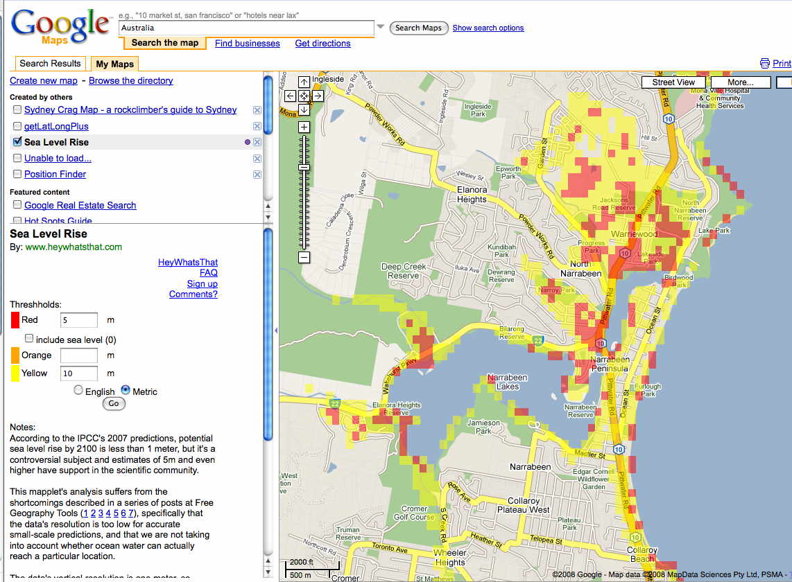
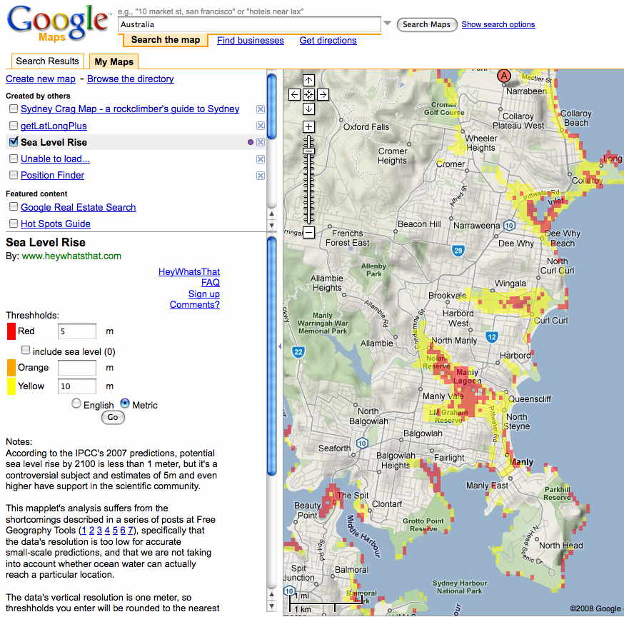
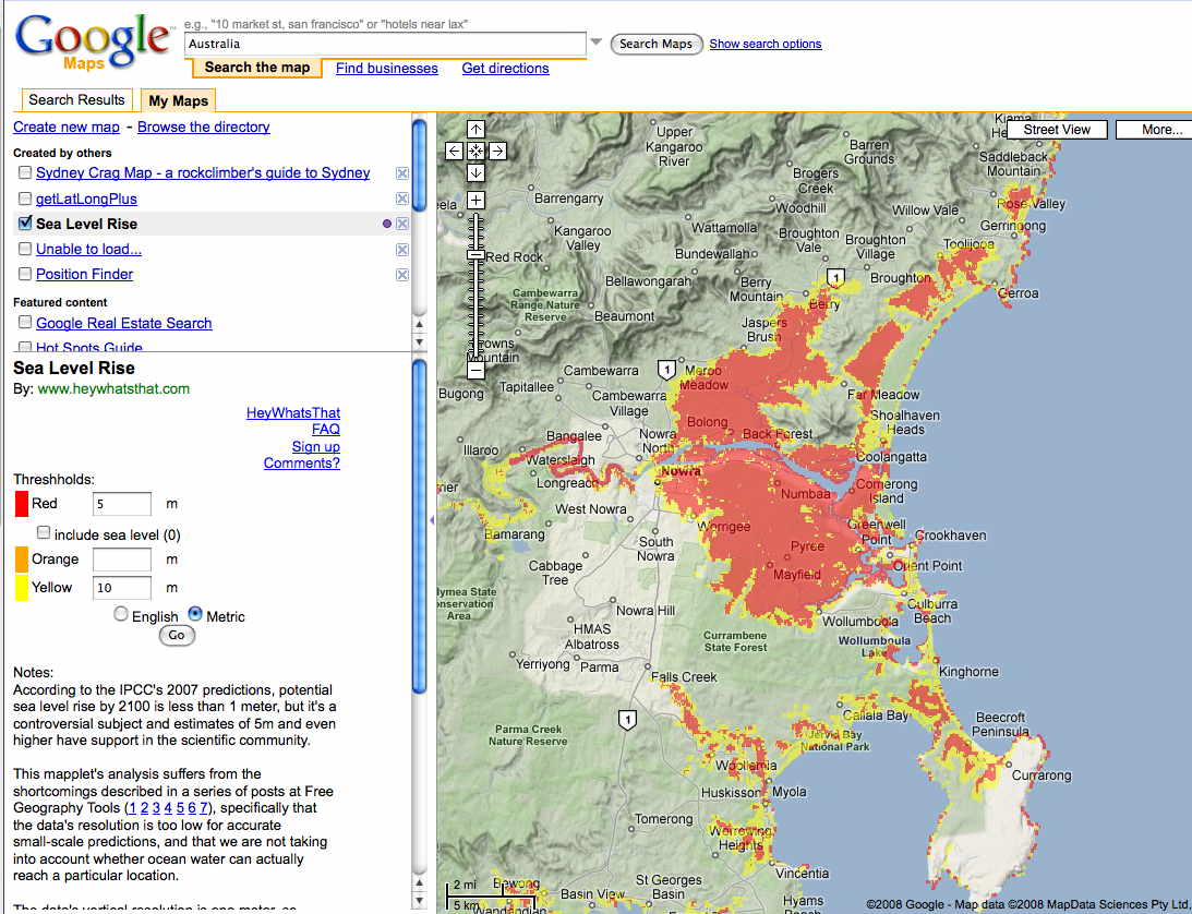
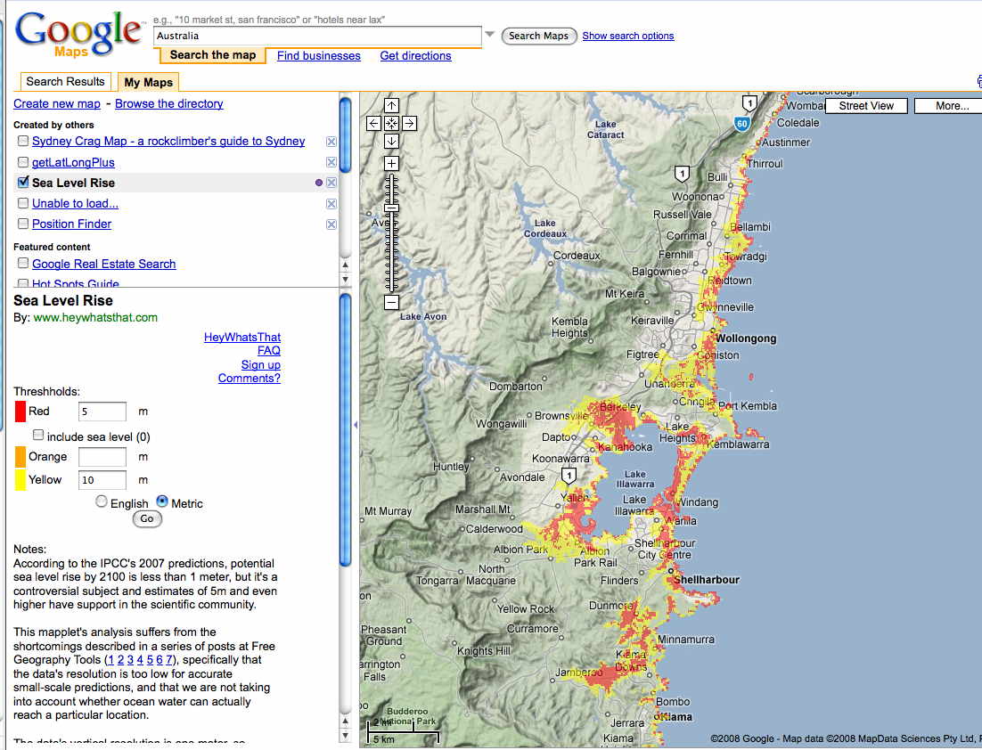
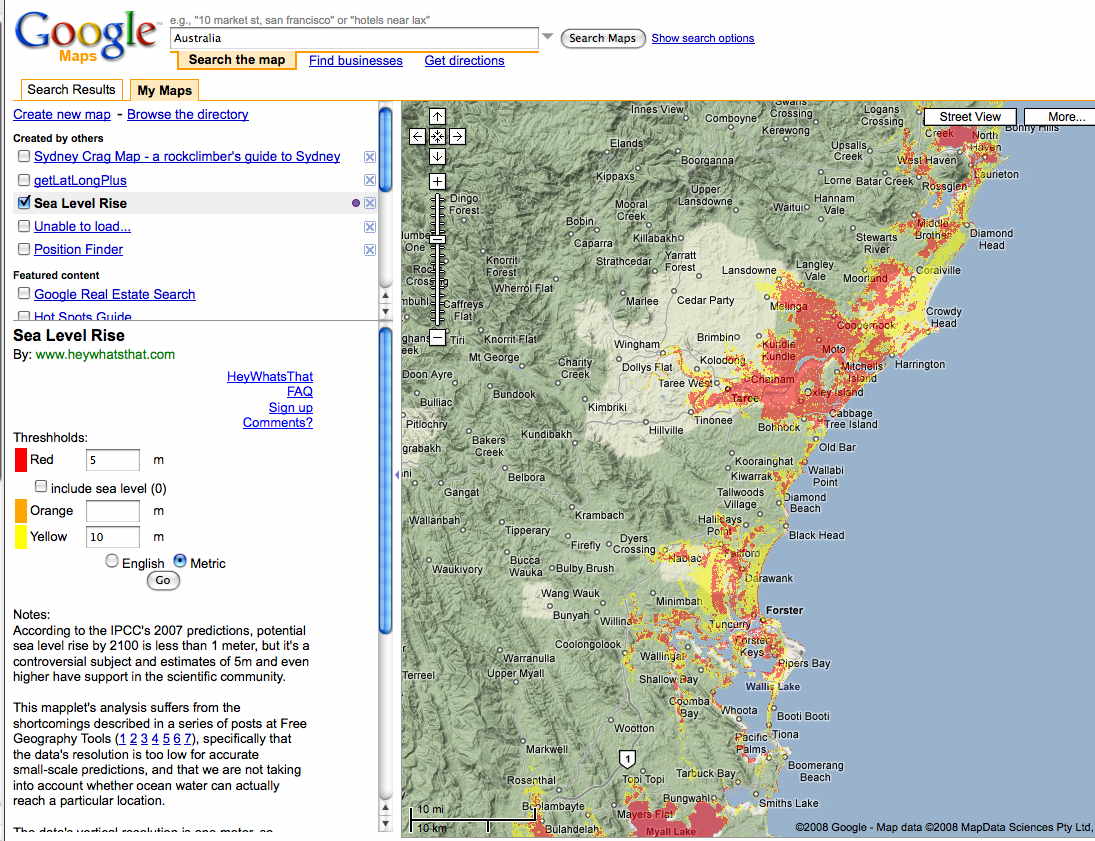
Google Maps has a sea
level
rise add-on (update: no longer available - try this
tips page or Sea
Level Rise Explorer) that can give a very rough
guide (detailed modelling is needed to assess vulnerability as
there are many
factors
that influence tsunami inundation). The following links are to JPG screen
snapshots from Google Maps in
2008 - red shows 5m contour and yellow shows 10m
contour: - Narrabeen,
Manly,
Sydney
, Brisbane,
Gold
Coast, Sunshine
Coast, Nowra,
Wollongong,
Gosford,
Newcastle
and Forster
(Update Dec09: There are more accurate maps being developed by
SES organisations and this page will link to them when they
are published on the internet or try Sea
Level Rise Explorer). Update
June 2016: NSW SES now has similar maps online.
5 Nov 2017: Tsunami
safety day at Ettalong Beach.
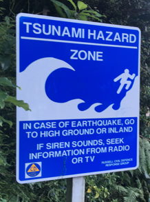
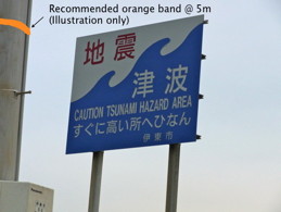
- Identify a safe location to go to in the event of a
tsunami warning - a nearby hill or headland or at least
the third storey of a reinforced concrete building
- Plan an evacuation route by foot to reach
that safe location (avoid the need for driving a car because
the roads will likely gridlock)
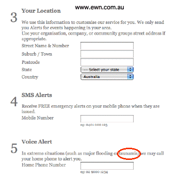
- Subscribe to the email or RSS warning service of the
US Pacific
Tsunami Warning Center
- Subscribe to a mobile phone alert service like the
Australian Early Warning
Network which offers anSMS
service that relays tsunami warnings issued by the
Australian Bureau of Meteorology. The service also
covers other risks such as bushfires and cyclones. SMS-Tsunami-warning.com
is a similar international service. With hundreds of thousands
of people potentially afffected, you may not be able to rely
on the Internet, landline telephones or mobile phones at the
height of a tsunami emergency so have a portable radio
available for receiving updates.
- If you receive a tsunami
warning that is relevant to your location, or feel an earthquake, quickly
get your evacuation plan into action. If a mega-tsunami
does inundate the area do not return to low-lying land
until given the all-clear by emergency services as other
waves are likely to follow after the first wave and each
wave can last for 20 to 30 minutes. The danger may last for
many hours and possibly more than 24 hours.
- Approach your local council and politicians and ask
to support (ie fund) State SES to develop tsunami warning
action plans and infrastructure (such as a public address
system) and to have inundation modelling carried out. See
the [NSW] State
Tsunami
Plan( pdf 2311kb) - issued in 2005. See Tsunami
Notification Zones for British Columbia as an example.
- Most importantly, relax and enjoy living near the
ocean, knowing that you have made basic
preparations for a worst case scenario
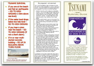
Update Nov09: Brochure "
Tsunami
Survival Guide" based on the above tips
"If you are at the beach and feel an earthquake – GO TO HIGH
GROUND" -
don't wait for a
tsunami warning signal because the tsunami could arrive in less
than 30 minutes (advice from tsunami expert
Dr
Charles Mader who, sadly, died on 18 August 2018)
Tips from a tsunami survivor
These tips are from Kristin Fedorow, an Australian who
survived the 2004 tsunami on the Thai coast:
1) Tsunamis usually have more than one wave
2) The later waves are usually much bigger
3) The water does not necessarily recede before the wave
approaches
4) The wave does not necessarily look big as it comes in
5) The time between waves can be much longer than a few minutes
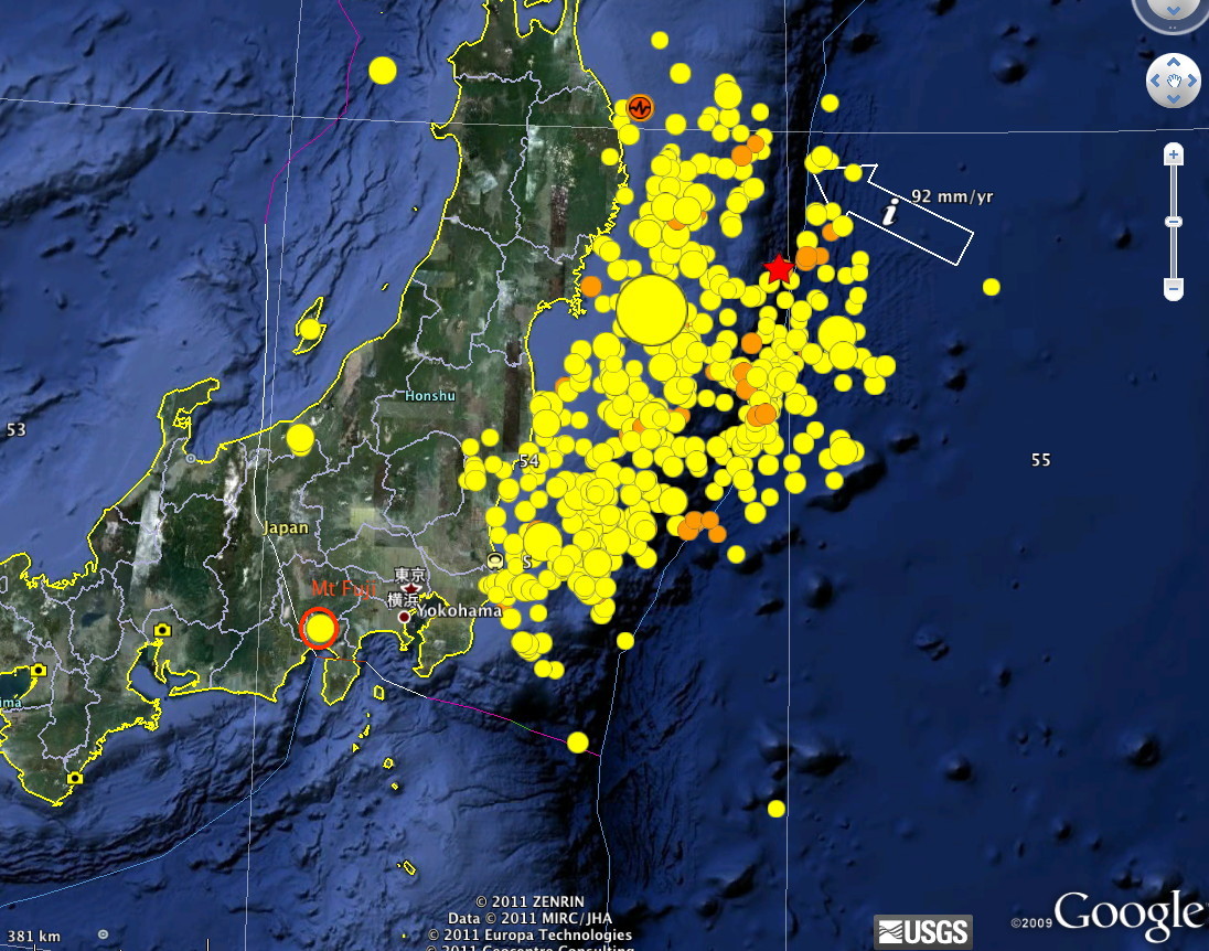
These points are illustrated in these Youtube videos:
Japanese
mega-tsunami in 2011
and this confronting movie about the 2004 tsunami:
The
Impossible.
The Norwegian move
The
Wave (2015) has a strong message about community preparednes
Slide show presentation on the
tsunami hazard to Sydney (by Michael Paine at a Friends of
Narrabeen Lagoon Catchment meeting, March 2008)
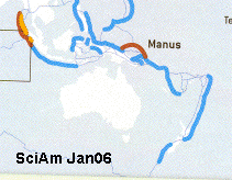
Includes recent computer modelling of a mega-tsunami from the
Tongan Trench that has similar features to the 2004 Indian Ocean
Tsunami.
- 12Mb
Quicktime
presentation + Youtube
version
- 3Mb
PDF
of the presentation
- Notes for
simulation of an Magnitude 9 earthquake at the Tonga Trench
by Dr
Charles Mader (from the DVD with his text book Numerical
Modeling of Water Waves). The chances of such an
extraordinary but deadly event are unknown at this stage
(however, a magnitude
7.9
earthquake occurred near Tonga in 2006 and a Magnitude
earthquake
8.1 occurred south of New Zealand 3 days before the 2004
Indian Ocean event. Update: 8.3 quake near
Tonga on 30 Sep 09). The Mader modelling was based on
the actual tectonic movements for the Sumartran earthquake
that caused the 2004 Indian Ocean tsunami (Aug08: assumption
independently
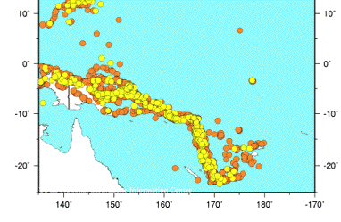
confirmed). Others have noted that the Tongan Trench is
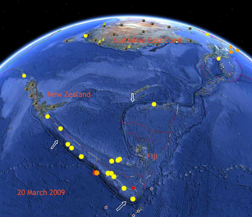
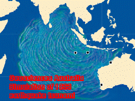
the fastest known subduction zone. The resulting tsunami is
particularly devastating for the East Coast of Australia, with
a predicted height of
around 10m (the deep water wave height would be
less than that modelled due to dispersion but the shallow
water amplification would counteract this effect meaning a
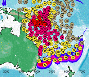
likely 10m runup along many coastlines). Apr 11 New Scientist: Japan disaster
suggests that Tonga is not immune to a Magintude 9 earthquake.
- It has been estimated
that
330,000 people live within the 10m elevation zone along
the coast (and many estuaries) of New South Wales. Adding the
Queensland
Coast the population at risk is likely around half a
million - something that deserves urgent attention.
- Recent Geosciences
Australia modelling indicates that a Magnitude 8.5
earthquake in the Tonga region is unlikely to pose a major
mega-tsunami threat to the Australian coast - which is good
news. The Magnitude 9 quake modelled by Dr Mader much larger
and much less likely to happen in our lifetimes. More
about the risk to Australia.
- 19 Aug 14 Scientific American: Big
Earthquake Looms for Chile - a long way from Australia
but a potential tsunami threat. This Wikipedia page has info
about the 8.2
magnitude 2014 Iquique earthquake that generated a 2.1m
local (Chile) tsunami. Travel time to the Australian
East Coast was 17 hours but the tsunami height was negligible.
However an 8.5 magnitude earthquake near Peru
in 1960 generated a small tsunami in Sydney and the
largest tsunami in Hawaiian history - see the lecture by
Charles Mader SWModel1.mp4 (download from here)
at around 24 minutes into the talk. Also New Scientist: Chile
is facing yet another massive earthquake "Fortunately
Chile has good systems for responding to earthquakes... It holds major evacuation drills
involving thousands of people. In coastal regions,
evacuation sirens warn of impending tsunamis, and alerts are
sent to cellphones and through Twitter." + Why
the [2010] Chile quake tsunami was smaller than feared
- 28 Aug 14 Uni Queensland: South
east Australia most prone to tsunami threats along eastern
coast.
- Reducing
The
Death Toll From Tsunami (written a fortnight after the
Indian Ocean disaster)
- 15 Aug 08 Breakthrough! Illawara Mercury:Tsunami
a real threat to Illawarra: professor - a tsunami education and
evacuation plan for Illawarra would be released in November.
- 19 Apr 09 - Tasmanians
becoming prepared.
- 1 Oct 09 ABC:
'No agreement' on [Australian] tsunami alert system -
Emergency services experts say Australia's tsunami warning
procedure is still lacking an effective alert system [following
the Samoan tsunami].
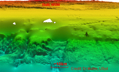
- 1 Sep 14 Cahill
Expressway interpretive display: The Great Eel at Boora
Birra [an aboriginal account of the creation of some of Sydney
Harbour, according to F. Bodkin, 2001]: ...The Earth began to
shake violently, and a
great chasm opened up in the ground, following the
fleeing lawless ones and swallowing them as they fled towards
the flatlands. Then a storm came in from the sea, and the waves crashed across the
flatlands until they reached the cliffs that marked the
beginning of the highlands. [this could well be a
description of mega-tsunami, such as the one that probably
arose from the Bulli Slide a few hundred
years ago]
- 25 May 2015 New Scientist: New
Zealand's worst earthquake fear confirmed by sediment survey
- evidence of a huge megathrust earthquake crossing segment
boundaries there some 500 years ago [source of the mega-tsunami
on the east coast of Australia?] BSSA
Abstract.
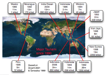
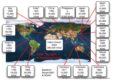
This horrific tsunami was caused by
an earthquake - not an asteroid - but the consequences are
similar. Like the
asteroid threat,
warnings from experts about the risk and consequences of major
tsunami have been largely ignored, except in Japan and Western
USA.
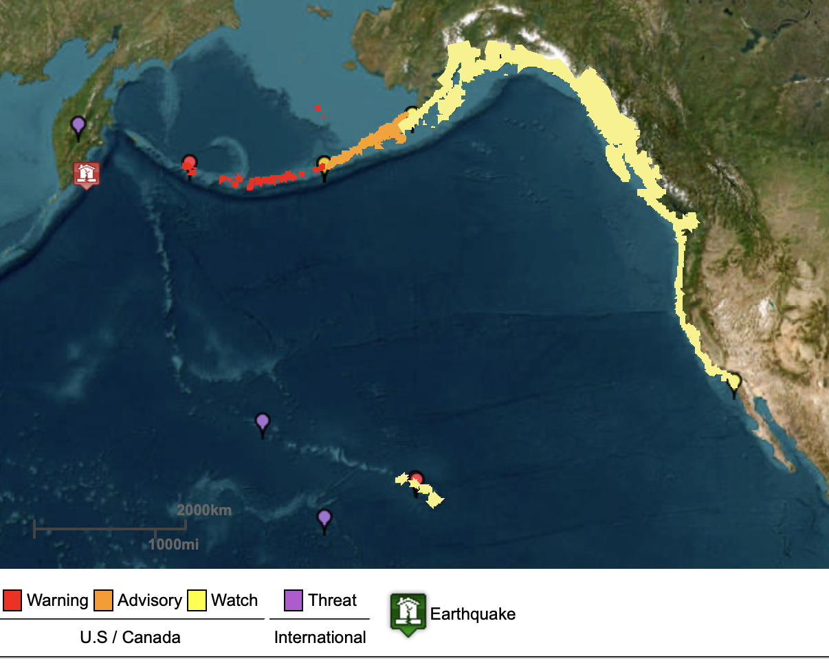
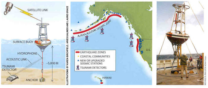
Japan and the USA have a very a effective
tsunami
warning
system in the Pacific Ocean. It is based, partly, on
pressure
sensors
on the ocean floor. Tsunami waves are so long that they
change the pressure at the seafloor whereas wind waves get
smoothed out.
It would be possible to set up a similar tsunami warning system in
the Indian Ocean - for a few $million (ie the cost of a few cruise
missiles)! However some locations, such as Sumartra, were
probably too close to the source of the tsunami for a warning
system to be effective and in other areas communication
limitations might hinder evacuation.

 Hazards Prediction" - a report by Phillip Watts on a
2000 workshop in
Hazards Prediction" - a report by Phillip Watts on a
2000 workshop in 

![[back to
spaceguard home!]](myhome1.jpg)